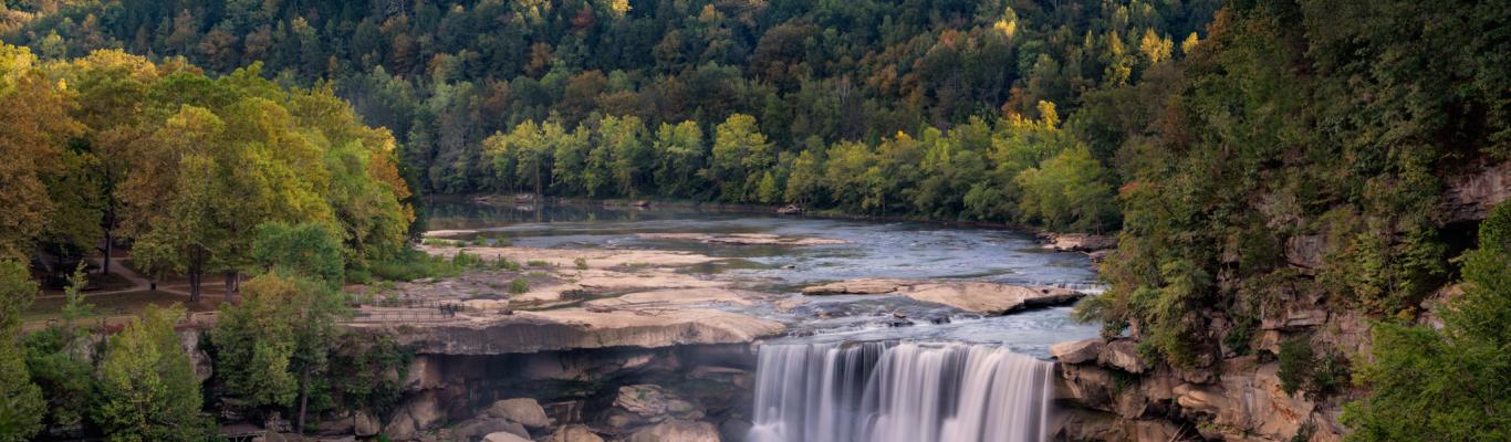
The Big South Fork National River and Recreation Area, located in scenic McCreary County and stretching across the border through several counties in Tennessee, is one of just nine national park system units in Kentucky. True to the reputation of the park system, the natural beauty of the area does not disappoint!
In addition to river-based activities and the opportunity for a ride on the Big South Fork Scenic Railway, the park plays host to an abundance of hiking trails that lead to waterfalls, natural arches, gorgeous overlooks and an abundance of unique natural features. Even better, there is no entrance fee for the Big South Fork NRRA or for any of its hiking trails, so this a great low-cost activity.
Yahoo Falls
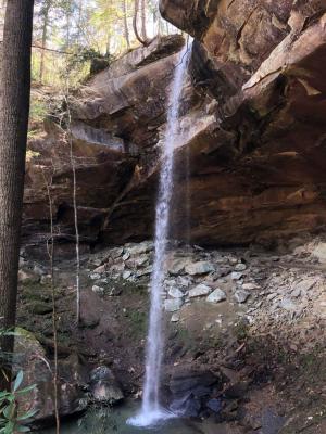
Located just north of Whitley City, Yahoo Falls drops from 113 feet, making it Kentucky’s tallest waterfall. Going clockwise on the one-mile loop trail leads down a steep set of metal stairs to the base of the falls and the trail continues through a large rockshelter that goes behind the falls before returning up switchbacks to overlook viewpoints of the falls on the way back to the parking lot. Other than the stairs, the trail is easy and well-maintained. To make the hike longer, follow a spur trail for 0.8 miles (each way) to visit Yahoo Arch in the adjoining Daniel Boone National Forest.
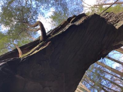
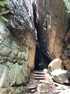
Split Bow Arch
From the Bear Creek parking area (follow the signs from Stearns to Bear Creek), one of the best short trails (a 0.6-mile loop) in the Big South Fork leads to the impressive Split Bow Arch and a set of wooden stairs allows hikers to climb up or down through the arch itself, depending on the direction of approach. Going left where the trail divides will lead to the base of the stairs, while going right will lead to the top of the stairs. While you’re there, don’t miss the view from the Bear Creek Overlook. The road that leads to the parking area is gravel, so plan accordingly.
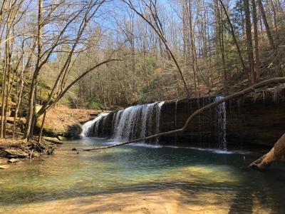
Princess Falls
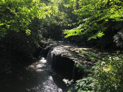
One of the most popular spots for locals, Princess Falls is a 1.3-mile hike (2.6-mile round trip) from the Yamacraw Day Use Parking Area, located off Hwy. 92 between Stearns and Monticello. The trail is easy with very little elevation gain, and many people enjoy taking a dip in the water under the falls, especially if visiting on a hot summer day. From the parking lot, follow the signs for the Sheltowee Trace. A small sign marks the trail to Princess Falls that branches off to the right near a wooden bridge that crosses Lick Creek. If you cross the bridge, you went the wrong way!
Blue Heron
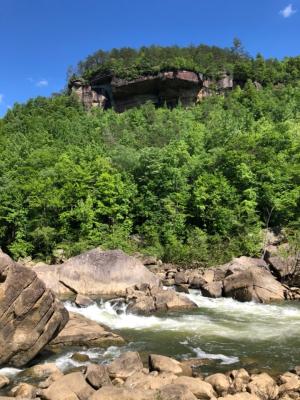
Located at the historic coal-mining operation that is now the Blue Heron Outdoor Museum, which is worth a visit in its own right, the Blue Heron Loop is a 6.5-mile trail that is rated moderate/difficult. For those with limited time or energy, the loop can be broken up to create shorter options. On the “top” side of the trail, a very short, paved trail leads from a parking area to the Devil’s Jump Overlook, which is one of my favorite viewpoints. From the Gorge Overlook parking area, at the end of the overlook road, it is a relatively short but very steep hike down to a unique feature named Cracks-in-the-Rocks. On the “bottom” side of the trail, from the end of the main Blue Heron parking lot, you can get a closer view of the Class IV Devil’s Jump Rapid (pictured on right below). It is a short hike of 0.6 miles each way, but be sure to exercise caution if you climb on any boulders.
More Information
For more details and current park status updates, I highly recommend visiting the official website for the Big South Fork NRRA.
The park website also features a guide to the Kentucky and Blue Heron hiking trails.
Frequently Asked Questions
What is Big South Fork famous for?
Big South Fork National River and Recreation Area is known for its river-based recreation opportunities, particularly whitewater paddling. It also offers miles of multi-use trails for hiking, biking and horseback riding. The area’s sandstone bluffs and gorges make it a popular destination for rock climbing as well.
Can I bring my dog to Big South Fork?
Yes, dogs are welcome to Big South Fork but must always remain on a leash. Leashes cannot exceed six feet.
How large is Big South Fork National Recreation Area?
Big South Fork offers 125,000 acres of natural arches, scenic gorges, waterfalls, overlooks, bluffs and forest to explore across the Cumberland Plateau along Kentucky’s southeastern border.
Is swimming allowed in the Big South Fork River?
Swimming in the Big South Fork River is not advised, but if you choose to do so, please wear a personal flotation device at all times.
Where is the Big South Fork River located?
A branch of the Cumberland River, the Big South Fork is a 76-mile river flowing through the Cumberland Plateau in Kentucky and Tennessee.